Snow Emergencies Declared as Coastal Storm Approaches
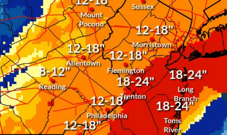
Although they may have preferred to enjoy the mild weather, residents and local emergency management officials spent much of Saturday preparing for a major winter storm that is forecast to bring as much as 18 inches of snow to the Lehigh Valley Sunday into Monday, with numerous municipalities declaring snow emergencies in advance of its arrival.
Hellertown borough’s snow emergency will begin at 9 a.m. Sunday, Feb. 22, and remain in effect until further notice, which means that vehicles must be removed from designated snow emergency routes before that time. The borough’s snow emergency routes are marked with signs and listed on the borough’s website. They include Main Street, Easton Road and most of Front Street. The borough noted in an email that vehicles that aren’t moved off snow emergency routes could be ticketed and/or towed at the expense of their owners, which is typical of snow emergency enforcement protocols. Parking will be available in the borough-owned lots at Dimmick Park, Water Street Park, Tobias Drive and the Hellertown Post Office.
A snow emergency has also been declared in Lower Saucon Township, where it will be in effect from 11 p.m. Saturday until 9 a.m. Tuesday. During a township snow emergency, parking is prohibited on all cul-de-sacs and dead end streets to facilitate snow removal by the public works department. Residents are also being reminded to clear snow from around fire hydrants–in Lower Saucon and elsewhere–so fire crews will be able to readily access them in the event of an emergency. More information may be found at Lowersaucontownship.org.
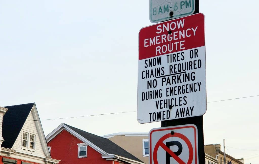
A snow emergency in Fountain Hill borough will begin at 8 a.m. Sunday along the borough’s four snow emergency routes: Delaware Avenue, Broadway, St. Lukes Place and Ostrum Street between Mohican Street and the St. Luke’s Hospital emergency room driveway. For more information about snow emergencies in Fountain Hill, visit Fountainhill.org.
According to the National Weather Service, snow may begin Sunday morning and could initially be mixed with rain in some areas. Heavier snow is expected to move into the area later on Sunday, with the heaviest precipitation expected overnight Sunday into Monday morning. Lehigh and Northampton counties are under a winter storm warning from 7 a.m. Sunday to 6 p.m. Monday, when travel is expected to become difficult due to reduced visibility and winds gusting as high as 45 mph. All of southeastern Pennsylvania and the Poconos are under a winter storm warning, while most of New Jersey, New York City and Long Island are under a blizzard warning for as much as two feet of snow and winds gusting up to 55 mph.
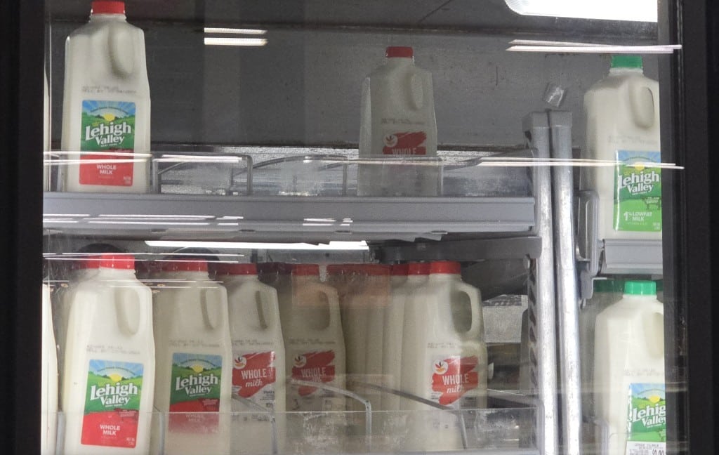
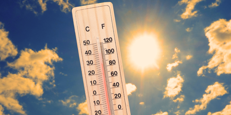
Temperatures Saturday were unusually mild, and business at supermarkets was brisk as shoppers grabbed milk, bread, eggs and other groceries, along with salt and snow shovels, if they could be found. With spring only a month away, supplies of winter weather-related items were running low in some stores and sold out in others.
Due to the forecast that includes gusty winds, power outages are possible Sunday and Monday. Officials said unnecessary travel should be avoided, and anyone planning to drive should keep food and water in their vehicle in case of an emergency.
In an email from Lower Saucon officials, drivers were reminded to keep their headlights on and never try to pass a plow truck.
PennDOT recommends that drivers maintain a distance of at least six car lengths behind plows, slow down and allow for extra time to reach their destination.
Residents should continue to monitor local news and weather outlets for updates on the developing storm. For updates on snow emergencies, they should follow borough and township posts on social media channels and via email subscription.

Author