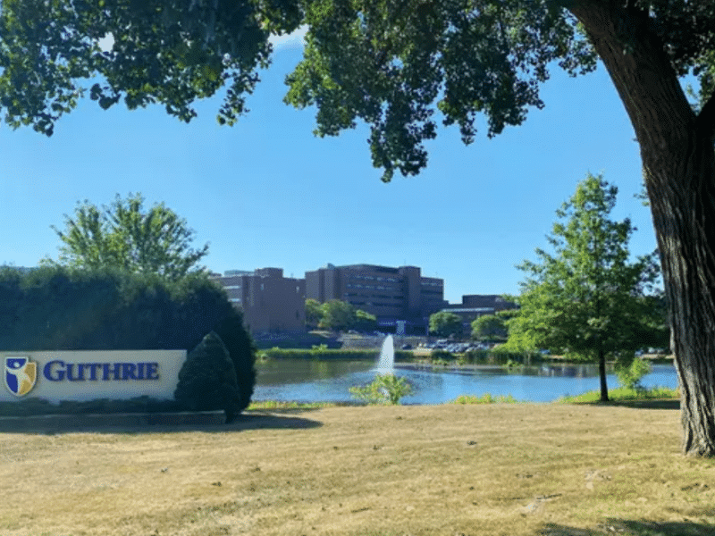
Fire Co. Wins Planning Commission’s Blessing for New Station
Six weeks after an industrial waste question tabled its Wassergass Road fire station application, Lower Saucon Fire Rescue got the recommendation it came for from the Lower Saucon Township Planning Commission.
Commissioners voted unanimously Wednesday to recommend approval the fire company’s land development application, subject to conditions in a recent Hanover Engineering review letter.
For the first time in several months, all seven planning commission members were present. Chair Chris Nagy ran the meeting from Town Hall alongside Vice Chair Jennifer Peters, Secretary Thomas Bartek and members Aleksandra Janjic, Veronica Gress and Shorav Kaushik. Member David Lankewicz–who introduced the industrial waste question at the July meeting–participated by phone.
Township solicitor Steven Goudsouzian and Hanover Engineering’s Andrew Youssef, the township’s engineering consultant, sat with the panel. Ian Kauffman returned as the applicant’s civil design engineer for Keystone Consulting Engineers, and Tony Medei, a battalion chief with Lower Saucon Fire Rescue, appeared on behalf of the fire company.
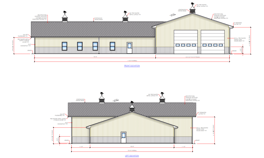
Kauffman walked the commission through the revisions in Keystone’s Aug. 20 response to Hanover.
LSFR added a row of trees between the parking lot and the east branch of the Saucon Creek; one of the specific requests the commission floated in July. It also added a 360-degree shield on the site’s proposed light fixture, reworked driveway grades and removed a pull-off area on Wassergass Road that Hanover had questioned due to it possibly being too close to the intersection with Crestline Drive.
That last change reduced impervious coverage on the site from 39,096 square feet of existing coverage to 31,800 square feet after redevelopment; a reduction of 7,296 square feet, according to the applicant’s revised stormwater narrative in the commission’s packet.
Total site disturbance remains 0.96 acres, which is under the one acre threshold that would trigger a state National Pollutant Discharge Elimination System (NPDES) stormwater permit requirement.
Lankewicz’s July request that Kauffman research whether the fire station could be considered “industrial” under state and federal water regulations dominated the first 15 minutes of the meeting.
Kauffman said he had not yet heard back from the Pennsylvania Department of Environmental Protection, but he took the commission through the federal stormwater regulation that spells out what activities count as industrial for permitting purposes.
Fire stations are not on the list, he said. The federal rulebook targets industrial plant yards, access roads and rail lines that haul raw materials or industrial waste, refuse and wastewater application and disposal sites, tank farms and specific industries such as logging, mineral industries, hazardous waste treatment and landfills.
He also inventoried what actually enters the site. There are no chemicals stored on site, he said, aside from an underground propane tank and a small quantity of gasoline in the garage for small motors. Trucks are washed inside the garage. The plan calls for a trench drain in the garage bay routed to the septic system, keeping any wash water contained and out of the parking lot.
Nagy asked if the fire company responds to a hazardous materials call, whether the truck could become contaminated.
Medei said Lower Saucon Fire Rescue’s operating protocol addresses that concern. If a truck is contaminated on a hazmat call, he said, it stays at the scene and a certified cleanup contractor handles the decontamination and any needed disposal of waste.
“It’s a loss for the fire company,” Medei said.
Kauffman said LSFR is planning to install an oil-water separator on the garage drainage, and that the septic investigation the commission had asked about in July is scheduled for Sept. 3. Historical documentation, he said, indicates there are three 1,000-gallon underground septic tanks on the property. The investigation results and any resulting design changes will be reflected in the applicant’s revised plans.
The application now moves to township council with the Planning Commission’s recommendation for approval.
In other business, the commisison reviewed a proposed zoning ordinance amendment on impervious coverage township council asked planners to weigh in on.
Youssef presented a summary of the amendment.
The backstory, Youssef said, begins nearly 15 years ago. Council at the time was seeing repeated variance requests from homeowners whose lots did not have enough remaining impervious coverage to add a deck, pool or shed, because builders had already used the entire allowable percentage on the original construction. Council responded by creating an impervious coverage table in the Lower Saucon zoning ordinance. That table restricted overall site impervious coverage, factored in coverage from roads and set a maximum impervious footprint for residential buildings.
An unintended consequence, Youssef said, was that the table over-restricted residents. Township staff has seen sketch plans in rural zoning districts where lots cannot be developed to any reasonable extent under the 2011 table. The proposed amendment would eliminate that table and revert to the district-level impervious coverage limits that existed before. To preserve council’s original goal–leaving wiggle room for the eventual homeowner–the amendment adds language capping a builder’s initial permit application at 85 percent of the district’s allowable impervious coverage, with the remaining 15 percent implicitly reserved for future accessory uses like pools. It also reiterates that lot-level impervious coverage cannot exceed what the subdivision’s stormwater management facilities were designed to handle.
The commission’s discussion focused on the details. Kaushik asked whether the 85 percent rule was clearly written and how it handled nonconforming lots. Bartek asked why the amendment defined a new term, “impervious surface ratio.” Youssef said it is intended to replace the definition of “impervious surface area” and functions the same as a percentage.
Goudsouzian relayed a related concern the Lehigh Valley Planning Commission had raised in its review letter: that municipalities should not apply different standards to builders and homeowners.
“They’re suggesting essentially treating everyone the same, but that doesn’t solve the problem we’re trying to solve,” Goudsouzian said.
Nagy proposed that instead of separating builders from owners, the ordinance separate principal use from accessory use, capping impervious coverage for the house and its driveway at one percentage and for accessory uses like pools and sheds at another, with the same rules for everyone.
He moved to recommend that Council look at the ordinance under a principal-use versus accessory-use framework, and the motion passed.
The last business item was a review of the township’s official map, which Youssef said has not been meaningfully updated since the 1970s.
The proposed update reflects current parcels, roads and waterways and reflects municipal planning code requirements.
Kaushik asked why Hellertown Borough parcels within Lower Saucon appeared purple while the borough itself was left white, and why the map’s parks and open space came out blue rather than green.
Youssef said the color choice for Hellertown parcels was to distinguish borough-owned properties within the township from the borough itself, to avoid suggesting that Hellertown is part of Lower Saucon. As for the parks, farmland preservation is coded green on the map, so public parks and open space were coded blue to distinguish them. Kaushik suggested a hatched pattern as an alternative.
“It’s the greatest place to live,” Kaushik said as the panel wrapped its review.
Bartek moved to recommend that Council adopt the map, subject to the color comments. The motion passed. Goudsouzian said the draft map has already been circulated to the Lehigh Valley Planning Commission and neighboring municipalities for informational purposes.