Storm ‘Overperforming,’ 2 Feet of Snow Possible, Saucon Valley Being Buried by Blizzard of ’16
Saucon Valley residents are hunkered down and weathering the worst snowstorm to hit the region in 20 years.
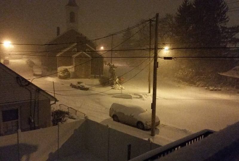
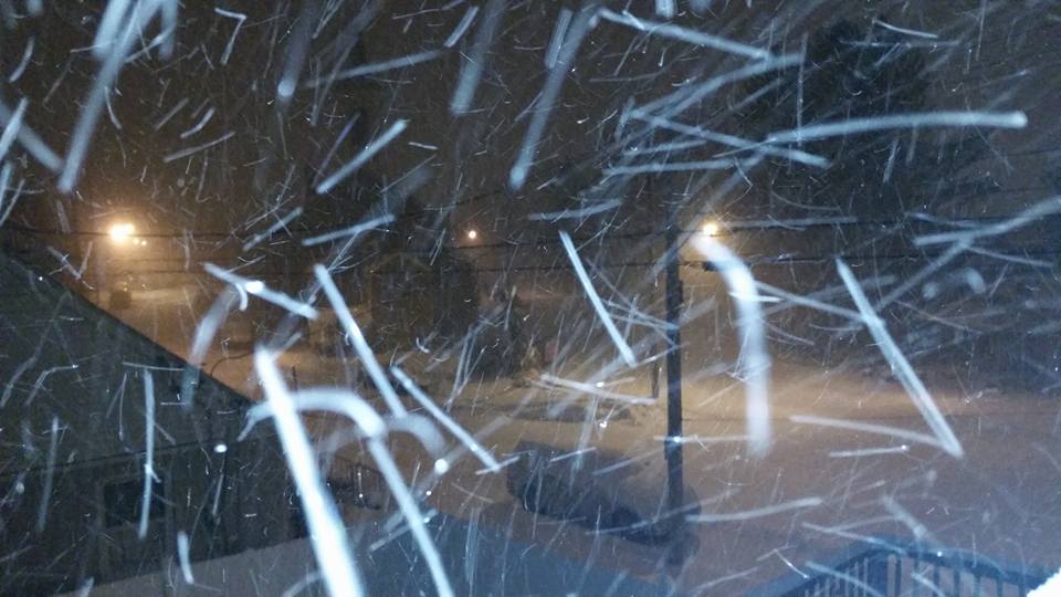
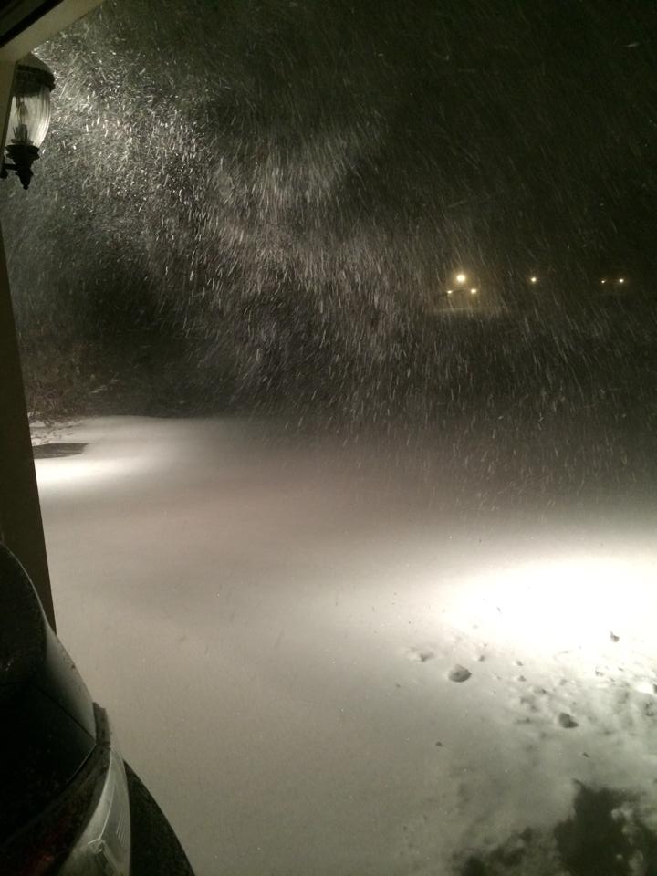
Saucon Valley residents are hunkered down and weathering what could be the most significant snowstorm to hit the region in 20 years; a storm that is turning out to be considerably worse than what was forecast by many media outlets just a couple of days ago.
The Blizzard of 2016 is a massive snowstorm that as of early Saturday continued to dump snow from Virginia north to New England, with the heaviest amounts concentrated in the Mid-Atlantic states. With snowfall rates of an inch per hour and greater, the storm is on target to rival the epic Blizzard of 1996 in terms of total snowfall totals and its crippling effects on travel and commerce.
A Harrisburg-based Facebook forecasting page called Pennsylvania Weather Action reported as breaking news shortly before 4 a.m. that the storm is “overachieving” in terms of the amount of snowfall it is producing across eastern Pennsylvania.
“The storm has moved farther north and closer to the coast than expected, meaning much of PENNSYLVANIA will now see the heaviest snow,” PWA wrote next to a map that places southern portions of the Lehigh Valley–including Saucon Valley–on the borderline between 15 to 20-inch and 20 to 25-inch snow total bands.
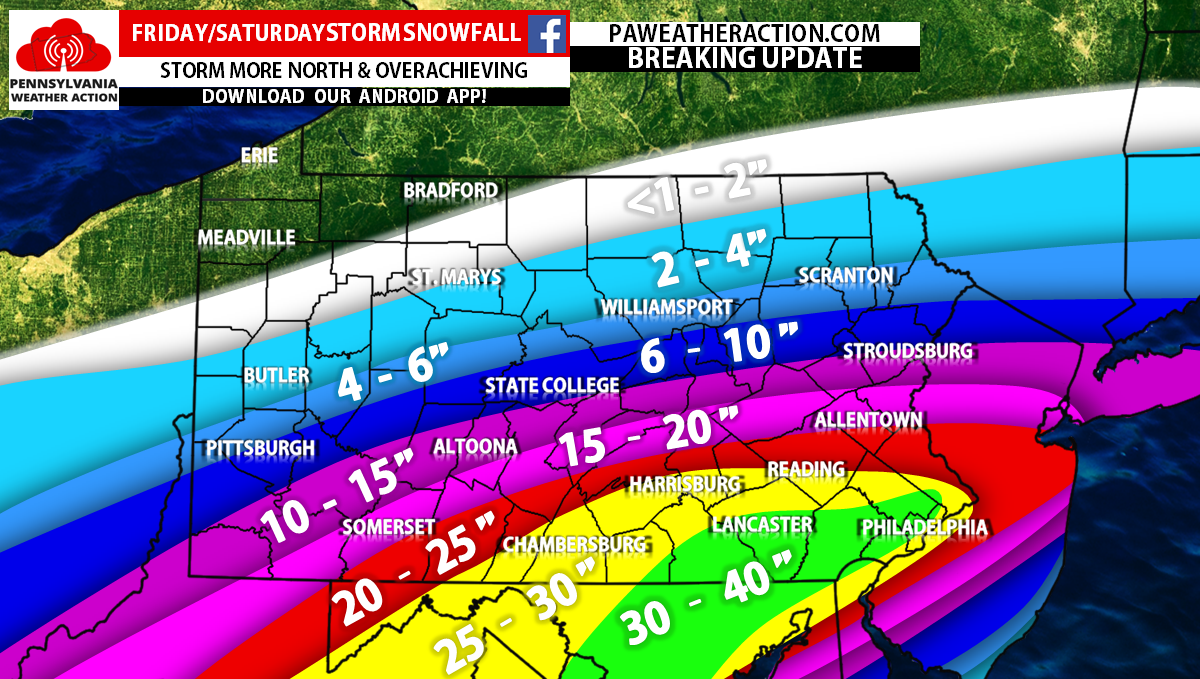
Snowfall totals of more than two feet should be “expected” from Somerset County east to north of Allentown, the page owners predicted.
Further south, Harrisburg and Reading were predicted to receive 25 to 30 inches of snow, and Lancaster, Philadelphia and Baltimore were forecast to receive as much as an astonishing 40 inches of powder.
Eastern Pennsylvania Weather Authority as of early Saturday predicted that most of the Lehigh Valley area would receive 14 to 20 inches of snow, with locally higher amounts possible. Likewise with PWA, the popular meteorology source predicted heavier amounts will fall south of the Lehigh Valley.
The National Weather Service updated its snowfall total prediction for the Lehigh Valley from 8 to 12 inches to 18 to 24 inches in an updated statement at 4:36 a.m.
Shortly after the first flakes began to fall at around 9 p.m. Friday, businesses in the Hellertown area began to announce they will be closed Saturday. The Hellertown Area Library and Saucon Valley School District campus are also closed, and snow emergencies remain in effect in the borough and Lower Saucon Township.
Updates from local officials can be found on the Borough of Hellertown’s Facebook page and via the Lower Saucon Township Police Department’s Facebook page.
PennDOT has reduced the speed limit on Interstate 78–which bisects Saucon Valley–to 45 mph because of the severity of the storm, and local officials and emergency responders urged area residents to stay home unless travel was absolutely necessary.
“Although PennDOT crews have been treating roadways, the department’s
primary goal is to keep roads passable, not completely free of ice and snow,” a news release said. “PennDOT will continue to treat roadways throughout the storm until precipitation stops and roads are clear.”
Motorists can check conditions on more than 40,000 miles of roadway, including color-coded winter conditions on 2,900 miles, by visiting www.511PA.com, which provides traffic delay warnings, weather forecasts, traffic speed information and access to more than 770 traffic cameras.
A winter storm warning issued by the National Weather Service remains in effect through early Sunday.
With the heavy snow and a threat of high winds has come the fear that power will go out, however according to PPL’s outage center map, as of early Saturday only a handful of customers in central Montgomery County were without electricity.
The storm is forecast to wind down by early Sunday morning.
Residents are advised to continue to monitor weather forecasts throughout the day, to avoid travel if possible, and to check on elderly neighbors during the storm.
Be sure to like Saucon Source on Facebook for ongoing updates about the storm. Saucon Source is also on Instagram and Twitter.

Author