Snow is in the forecast for Monday and Tuesday, but how much white stuff the Lehigh Valley will receive remains a big question mark.
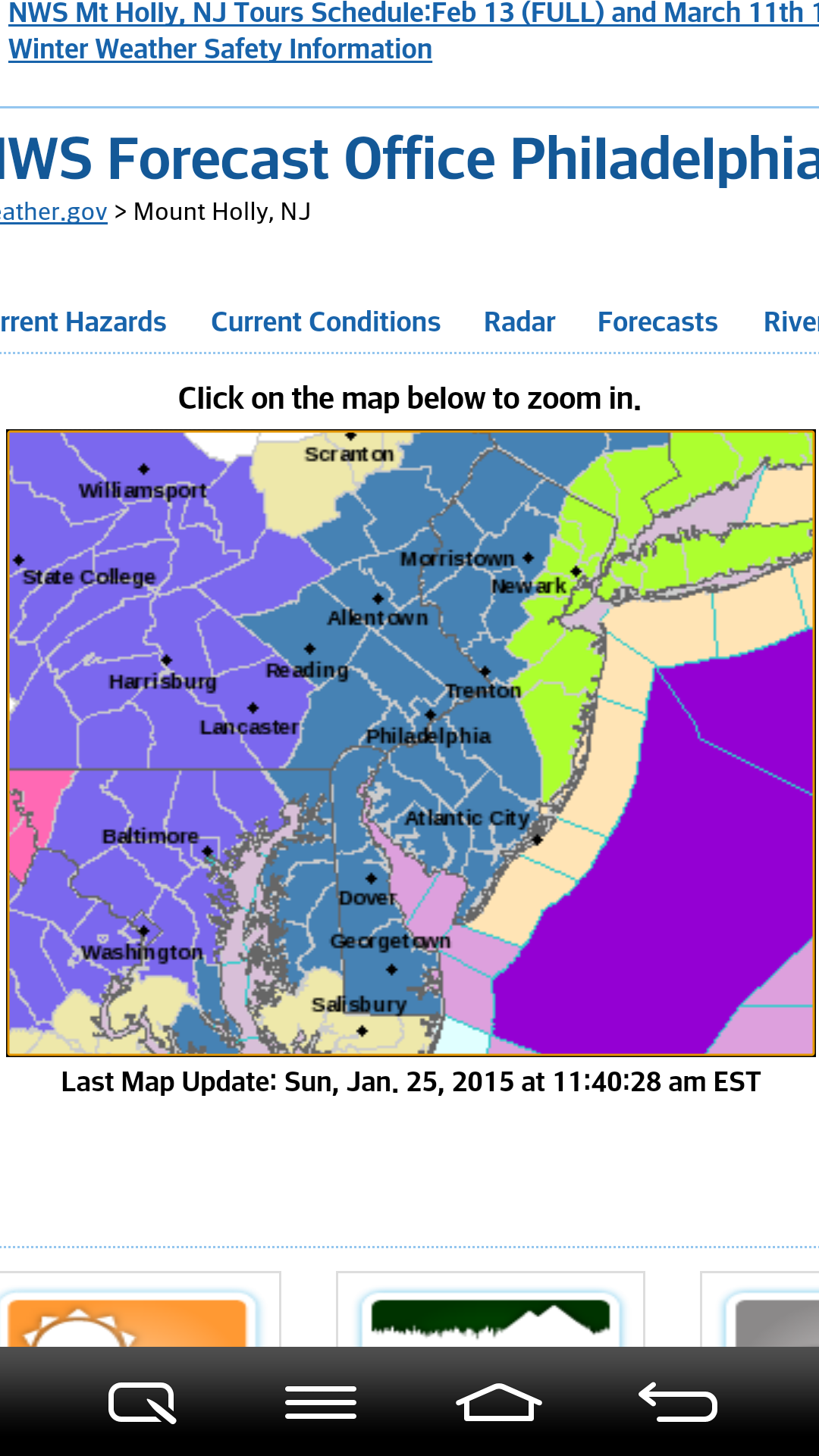
A National Weather Service map shows the watches and advisories that have been posted throughout the Mid-Atlantic region, ahead of a powerful winter storm that’s forecast to develop Monday.
Most meteorologists are in agreement that a significant winter storm will develop off the Northeast coast, overspreading snow across the region Monday. The timing and location of the storm’s development, however, will determine whether eastern Pennsylvania gets dumped upon or spared a potentially crippling snowfall.
The National Weather Service has issued a winter storm watch for the Lehigh Valley for six to 16 inches of snow from Monday afternoon through Tuesday morning.
A winter storm watch means there is a potential for significant snow, sleet or ice accumulations that may impact travel.
Meanwhile, blizzard watches for one to two feet of snow have been issued for the New York City area.
Area residents are advised to continue to monitor the latest forecasts.