With Cartography Business, Local Man Explores God’s Creation, One Map at a Time
Michael Sutherland is a local cartographer whose passion for places led him to start his own map-making business. In this interview, he explains how his interest in maps developed, what kinds of maps he creates and how anyone can order a custom map from him.
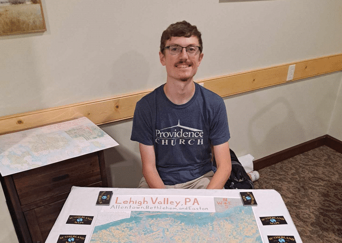
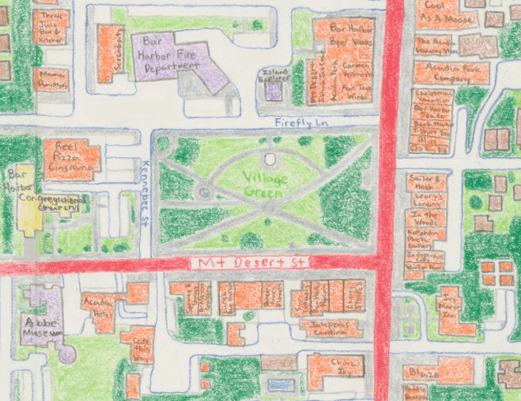
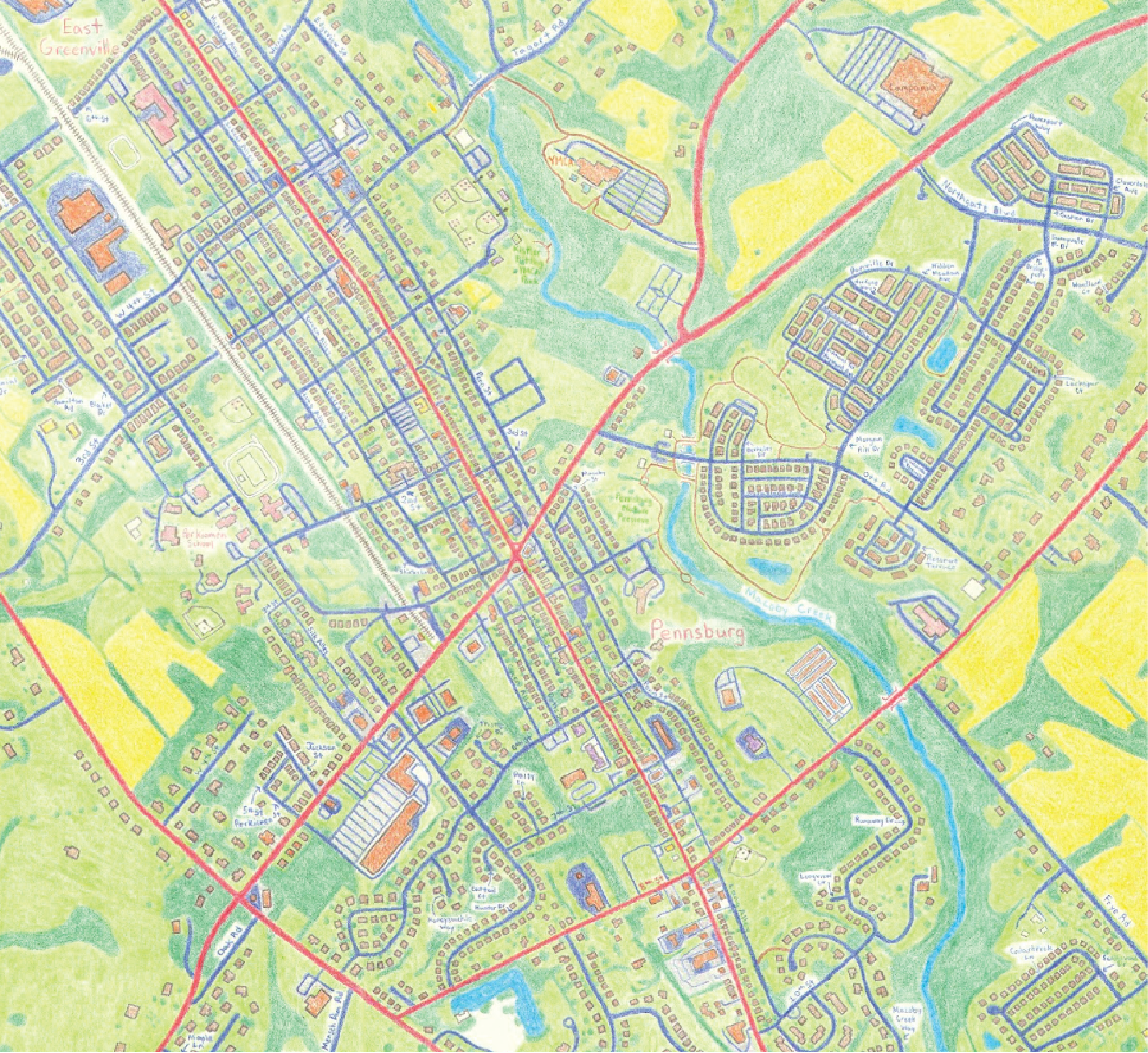
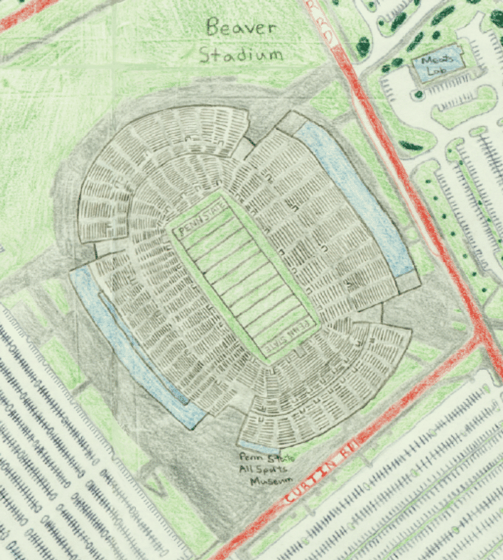
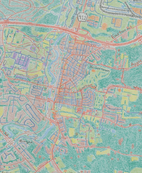
Editor’s note: Michael Sutherland is a local cartographer whose passion for places led him to start his own map-making business. In this interview, he explains how his interest in maps developed, what kinds of maps he creates and how anyone can order a custom map from him. Some examples of his work follow the Q&A, below. For further information, visit his website.
You grew up in the Saucon Valley area. Can you tell us a bit more about your background?
I moved to Hellertown with my parents and sister at the beginning of high school from Allentown. I had spent most of my childhood around the area though, visiting my grandparents who lived in Lower Saucon Township. While in high school I was involved mainly in cross country/track, but also the band/choir. Outside of that I was often at church over in Bethlehem for choir practice or youth group. Growing up I didn’t fully understand what it meant to be a Christian. That didn’t happen until college, when I realized the weight of my sin and need for a savior.
My grandfather worked for Lehigh in the engineering research lab. As a kid he sometimes took my sister and I over. I often think that if I was a better at math I would’ve been an engineer like him and most of my mother’s side of the family. I went to college at Penn State, studying Geography. I was one of the few freshmen who start off in the major and don’t fall into it. As it’s not commonly taught in school, most students don’t know it exists. Being someone who loved maps I knew that was the major for me. Currently I work remotely as a GIS analyst (making maps on a computer) for a commercial real estate company.
How did you first become interested in maps and map-making?
It’s hard to pinpoint an exact moment. I think it began with observing the neighborhood on walks as a kid and staring out the window on long car rides. I always enjoyed looking at my surroundings, trying to figure out what things were. And maps try to capture the landscape that I loved. I think also having a grandmother who was an artist inspired me to draw out what I saw. Taking a blank sheet of paper and drawing out what I loved was natural. As I’ve reflected on it more, cartography is analytic and artistic. Growing up amongst engineers and artists I think ending up in cartography makes sense.
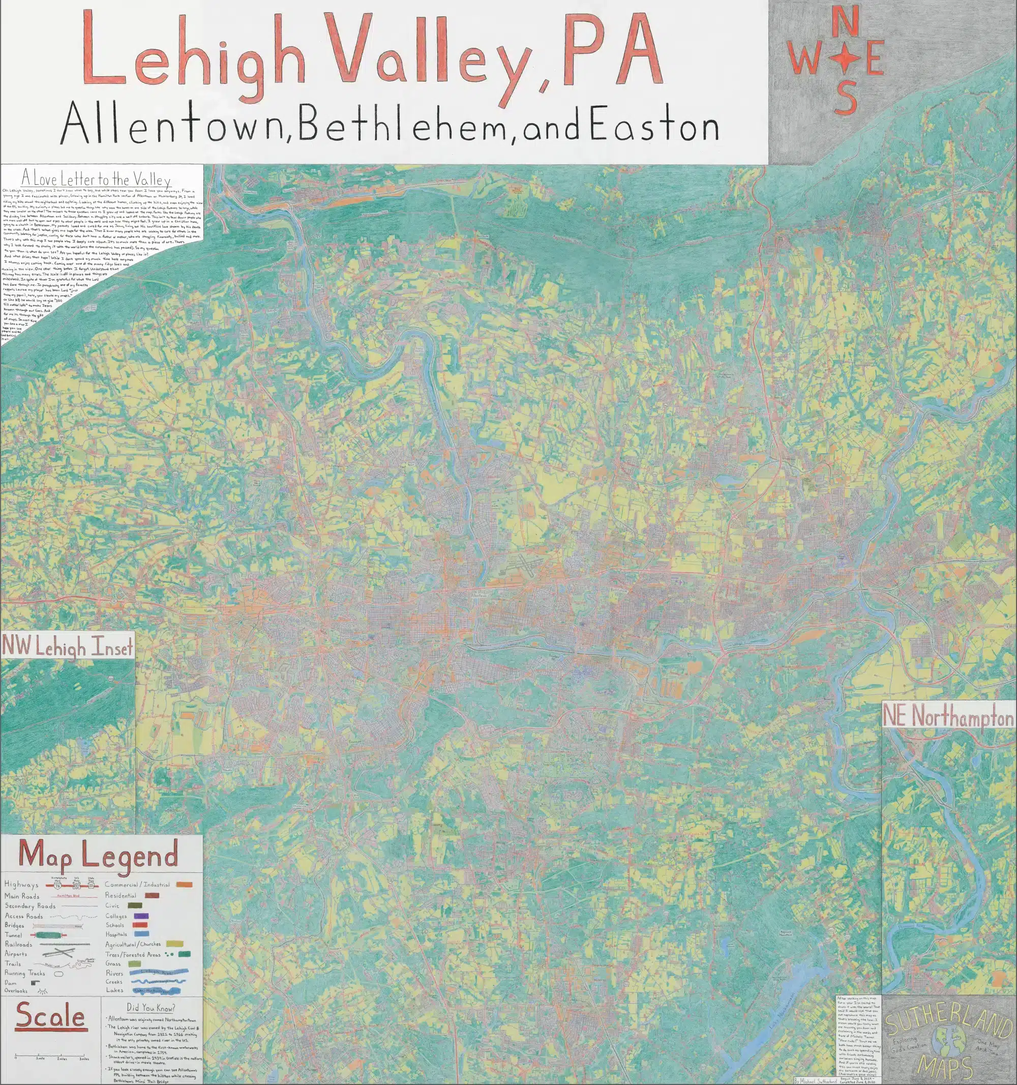
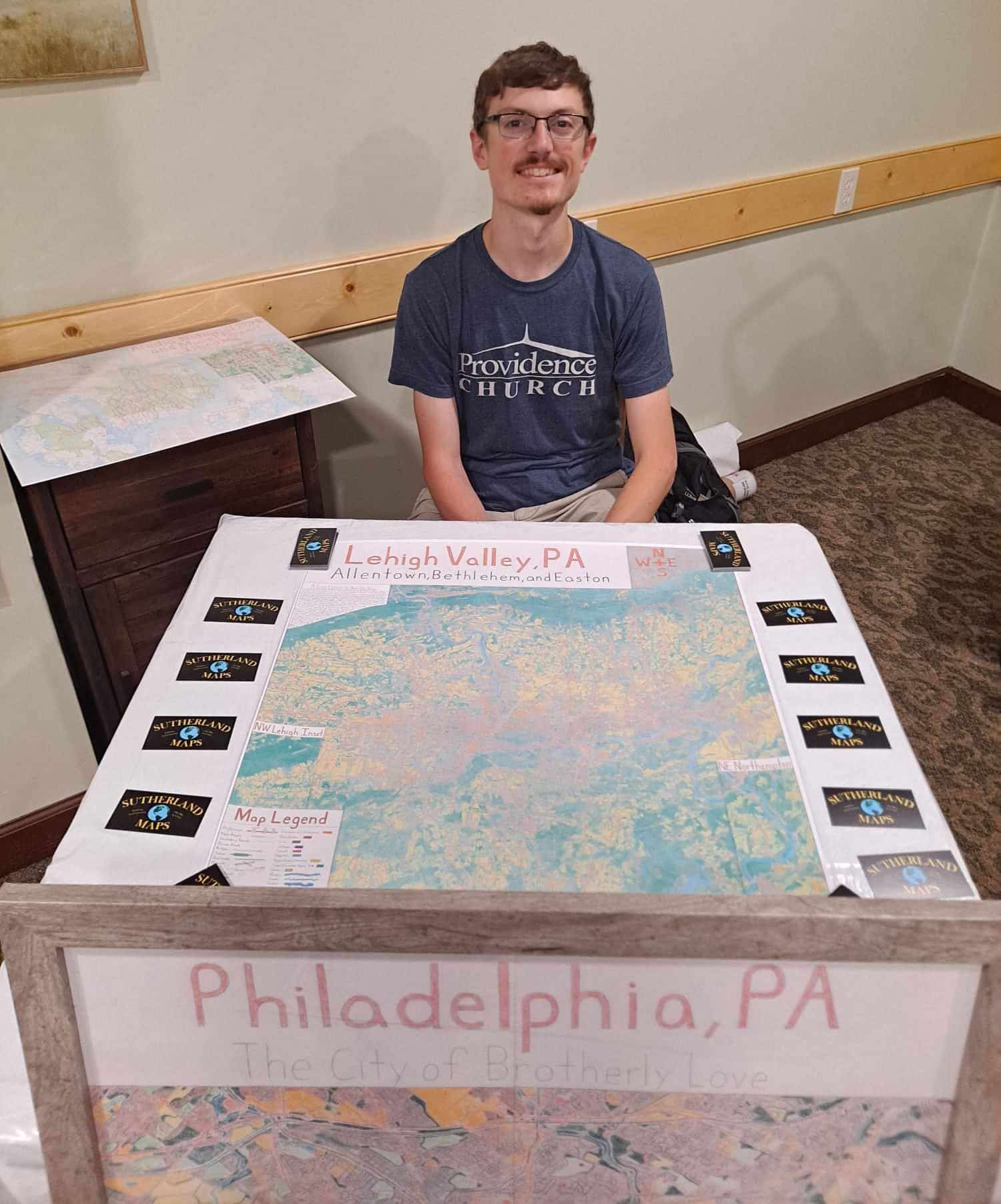
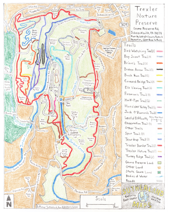
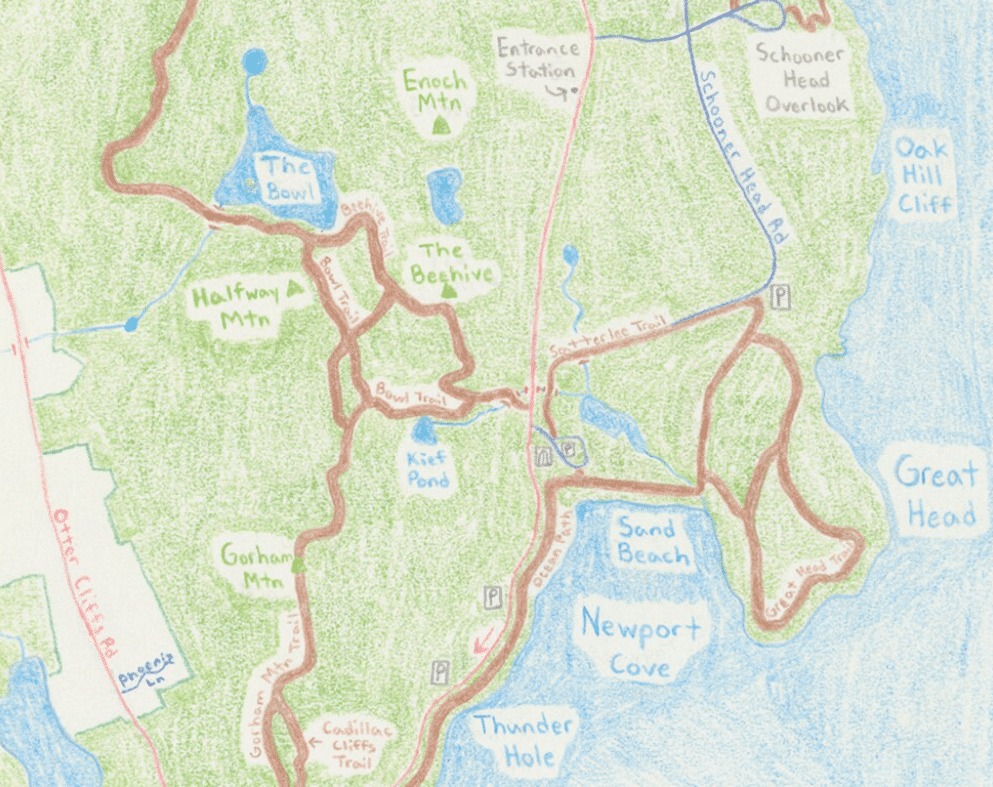
Like any skill I’ve seen the quality of my work improve as I’ve drawn out new creations. More often than not these projects are labors of love for places I cherish. Funnily enough, I actually created my company logo back in high school for an entrepreneurship class. My slogan “Exploring God’s creation, One Map at a Time” speaks to my faith as a Christian. Because I’ve been saved by Christ’s death on the cross, I want to strive to honor him in everything I do. My hope is that when people see my maps, that they see God’s glory through them. I couldn’t do any of this apart from him.
What was the first map you ever produced?
I created a map of an imaginary town where everything was named after my friends. This was in 7th grade, for an extra credit assignment. I ended up doing the assignment incorrectly. It was something about being a landscape designer and to me that meant ‘make a map.’ Thankfully, I still got credit and more importantly a lifelong passion was born.
You create both hand-drawn and digital maps. What is the production process like for them and how does it differ?
The process is relatively similar with a few caveats. The first step is to define the general project requirements. What size/orientation should it be? What area should be covered? What features are you trying to emphasize. I can then create a rough sketch of a map by hand or digitally. The big difference between the two is that project specifics need to be set in stone before beginning the hand-drawn works. Once I start using colored pencil it’s hard to change features, even though I can make minor edits in illustration software. Digital maps can be much more easily revised.
What are some of your favorite maps–ones you’ve produced and/or others you admire/draw inspiration from?
Purple Lizard Maps, based out of State College, creates trail maps for PA and beyond. When I met the founder in college he inspired me to go at it and make my own maps. Plus his maps can have fun, quirky details included, which I love. Anton Thomas is a cartographer from Australia who’s created beautiful maps of the world, emphasizing things like cities’ skylines or different animal species. His artistic capabilities are very impressive.
Are there any types of maps you can’t or don’t make?
My main limitations tend to be size. I find it difficult to create maps that are over three feet in length/width. It’s really on a project by project basis. I need to hear someone’s idea before I can make that call.
How long does it take to create a map? How do you normally display them?
It varies drastically based on the size/detail. Typically small maps (say 8 by 10 inches) can take 2-3 days, but large creations (say 2 by 3 foot maps) have typically taken 3 months.
How can someone order a custom map from you? Please explain the process.
The best way is to reach out at michael@sutherlandmaps.com. From there we can flesh out your project details with an in-person meeting or phone call. Before doing that though, checking out my work at SutherlandMaps.com or Etsy (SutherlandMaps – Etsy) would be helpful for people to brainstorm ideas.
Author