Due to the threat for severe weather this afternoon and evening, the National Weather Service has issued a tornado watch for the Lehigh Valley and much of eastern Pennsylvania.
The tornado watch was issued at 3:15 p.m. and is in effect until 11 p.m. for Lehigh, Northampton, Bucks, Montgomery and 13 other counties. Included in the watch area is the city of Philadelphia.
A tornado watch is issued when severe thunderstorms and tornadoes are possible in the watch area. It does not mean that they will occur, but is issued to advise the public that they are possible.
Severe thunderstorms are defined as storms with winds of 58 mph or higher and/or producing hail that is 1 inch in diameter or larger.
If a tornado forms, the National Weather Service will typically issue a tornado warning to alert residents of areas within its path to the danger.
In addition to the threat the Lehigh Valley faces from possible tornadoes, torrential rain from the expected storms could produce flash flooding, according to a NWS hazardous weather outlook.
The flooding is especially likely in urban areas, areas with poor drainage and areas along creeks and streams, the outlook statement said.
“Numerous severe thunderstorms are expected” Monday afternoon and evening, it noted.
As of 4 p.m. the temperature at Lehigh Valley International Airport near Allentown was 83 degrees, but due to high relative humidity it actually felt like 88 degrees.
At around 4 o’clock, National Weather Service radar showed several areas of rain embedded with heavy thunderstorms southwest of Harrisburg and north of State College. The lines of storms were rapidly moving east, meaning they could impact afternoon and evening rush hour traffic across much of eastern Pennsylvania and New Jersey.
Note: This is a developing weather story. Conditions may change rapidly. Residents should monitor their local weather and news outlets for additional developments throughout the day.
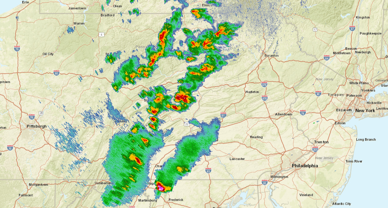
A screenshot of National Weather Service radar imagery taken shortly before 4 p.m. shows strong to severe thunderstorms developing across central Pennsylvania and moving east. The storms could produce tornadoes, which is why the NWS has issued a tornado watch for much of eastern Pennsylvania. (Credit: National Weather Service)


