Community Family

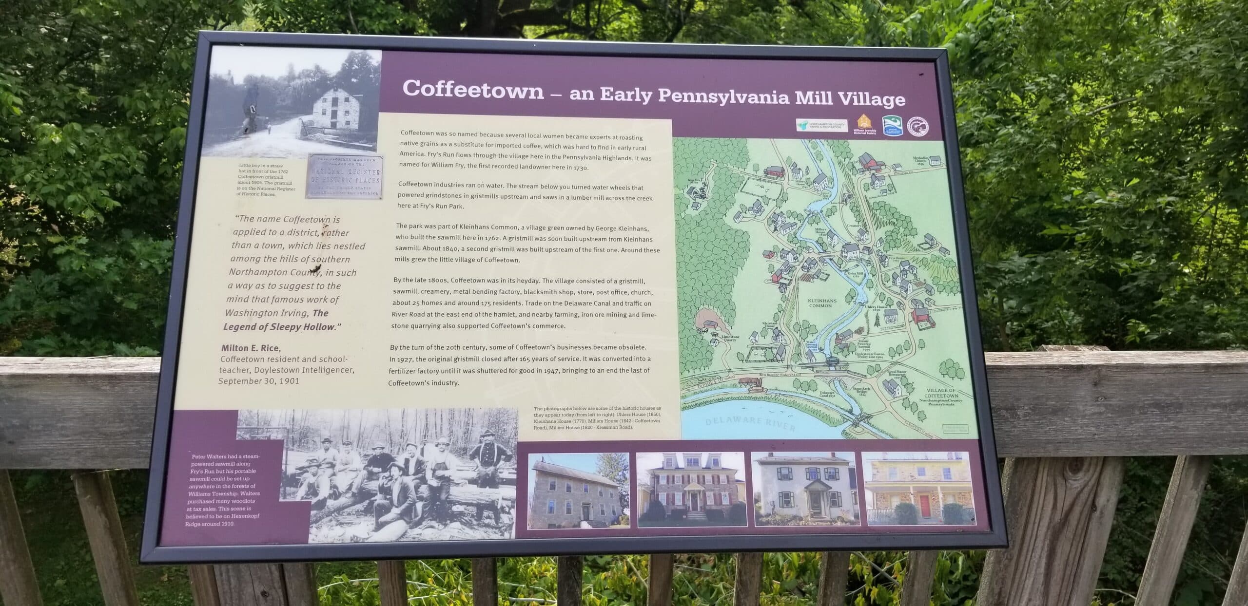
Cars Haven’t Crossed This Northampton Co. Bridge in Over 100 Years

Northampton County’s oldest bridge will soon be 200 years young, but that isn’t the only thing remarkable about it.

Est. Read Time: 5 mins

The historic M. Opp Bridge in Williams Township can be viewed from an observation deck in Fry’s Run Park, which is located just off Rt. 611 between Royal Manor Drive and Coffeetown Road, near the Delaware River.

Northampton County’s oldest bridge will soon be 200 years young, but that isn’t the only thing remarkable about it.

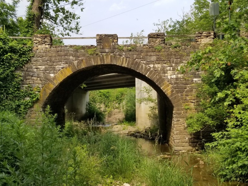
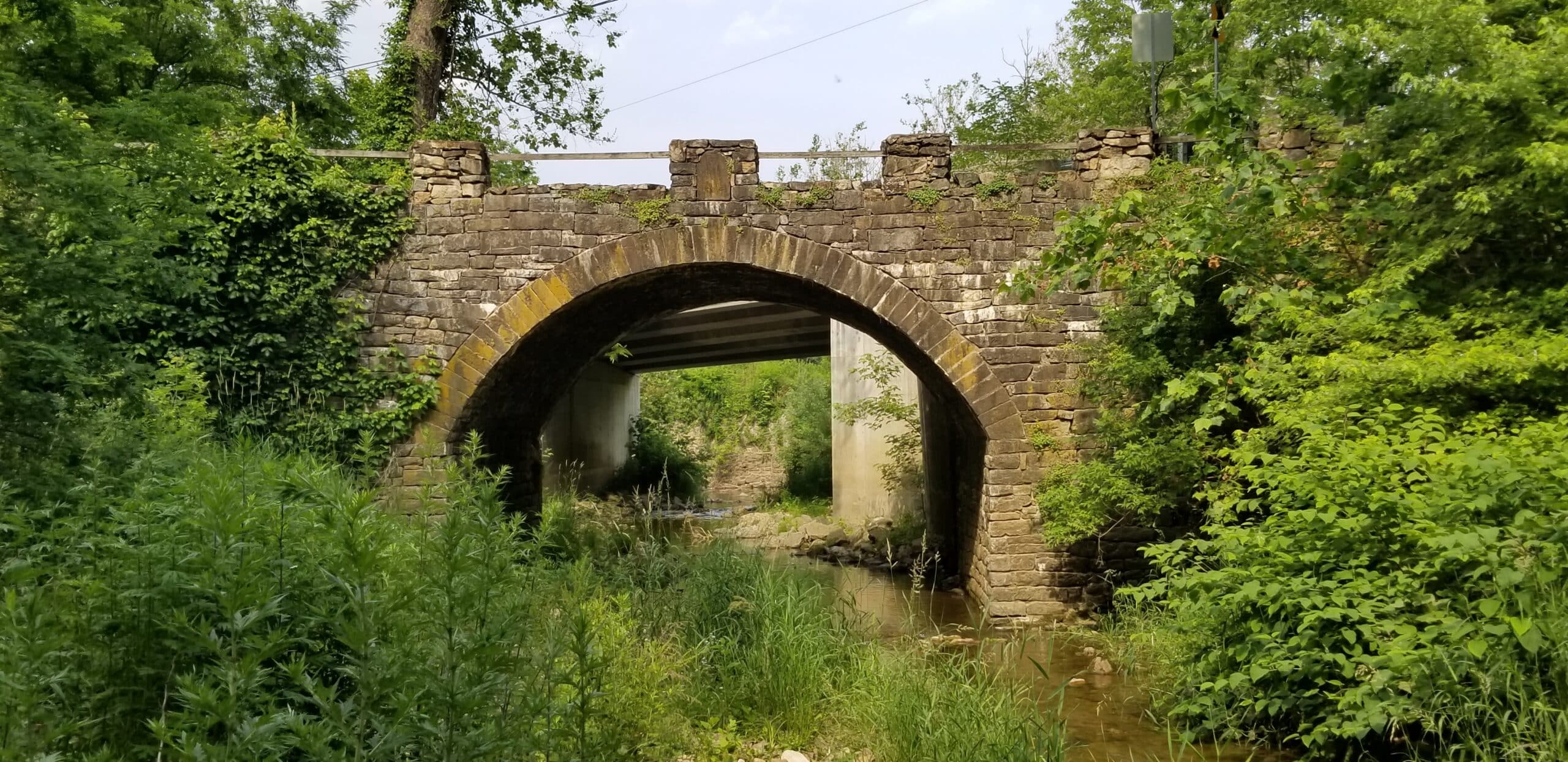
Cut off from the main route more than a century ago, the M. Opp Bridge near Coffeetown Road and Rt. 611 (River Road) in Williams Township is today a “bridge to nowhere.”

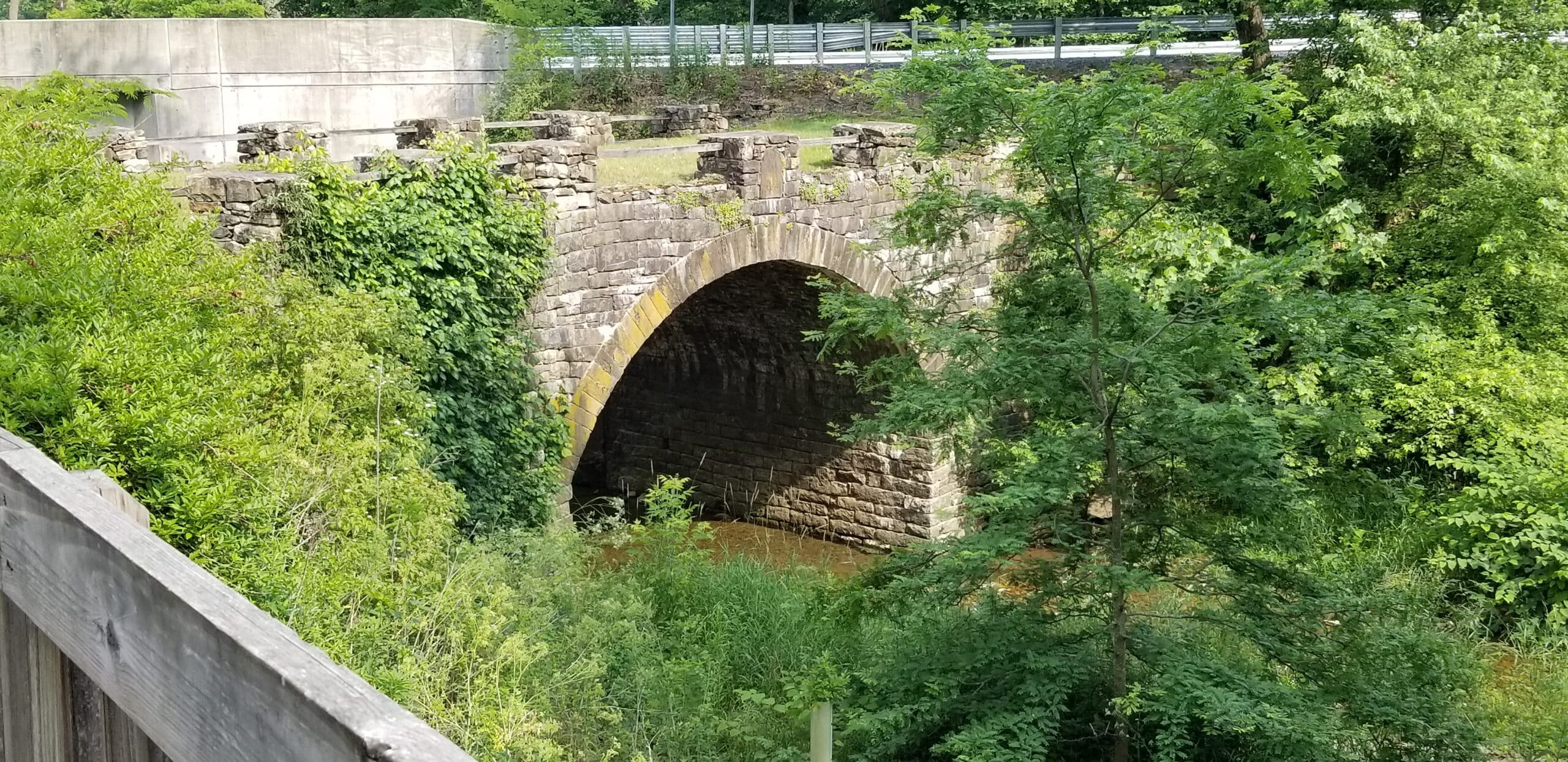
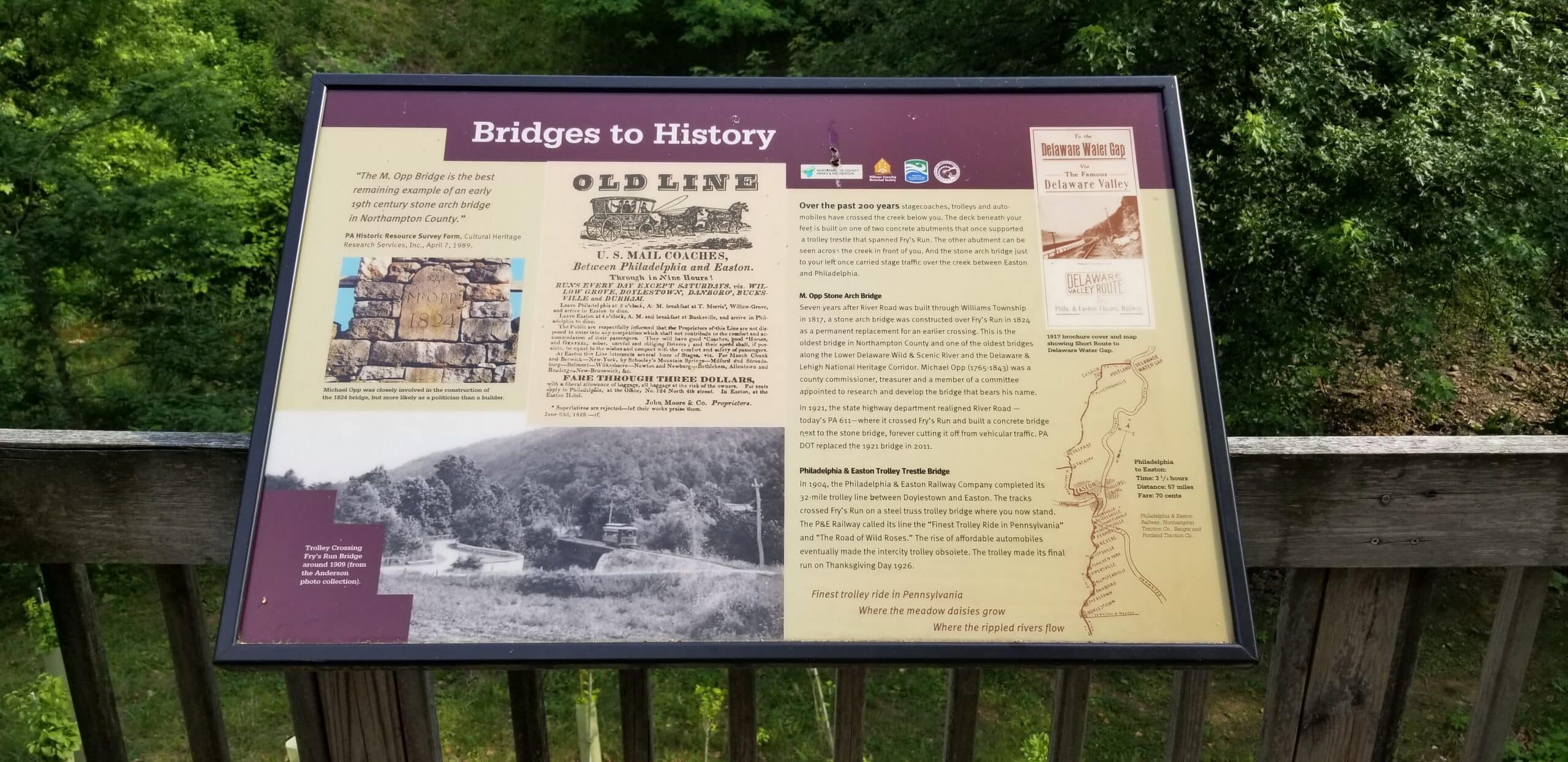
According to interpretive signage on a scenic overlook near the bridge–which is preserved in the county-owned Fry’s Run Park–the stone arch span became obsolete when the Pennsylvania Department of Transportation realigned River Road in 1921 and built a concrete bridge closer to the river. That bridge was itself replaced relatively recently, in 2011.

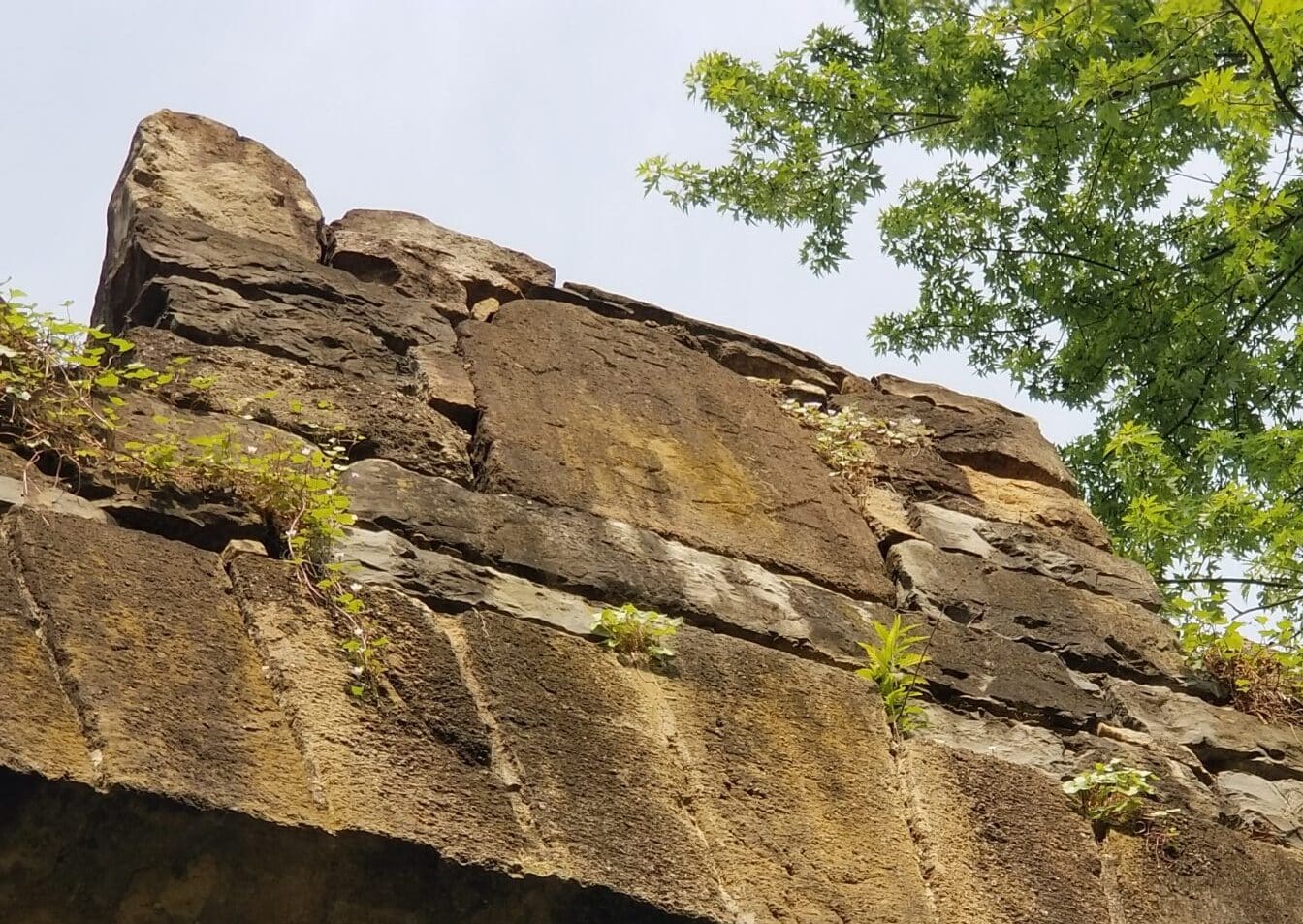
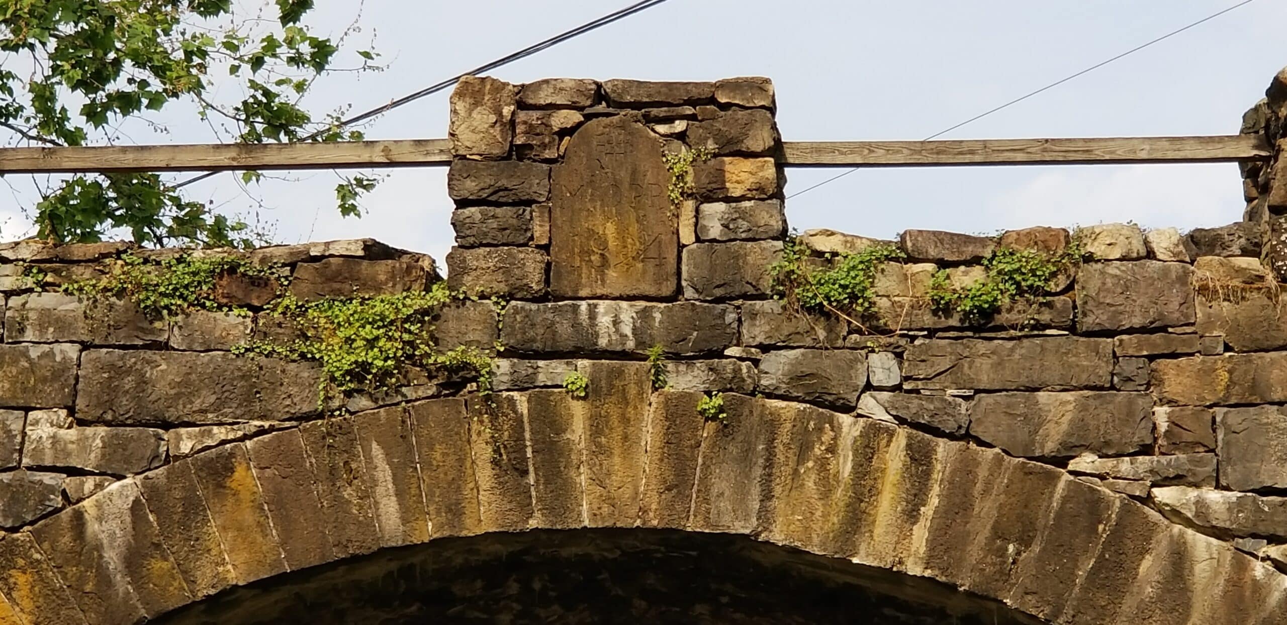
In addition to its grass-covered roadway, one of the unique things about the M. Opp Bridge as it exists today is the commemorative keystone inset at the top of its west-facing arch. The stone is inscribed with “M. Opp” and the year of the bridge’s construction (1824), and is still legible under certain lighting conditions.

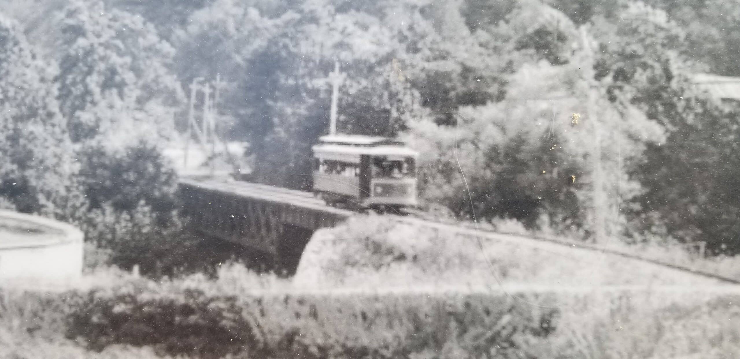
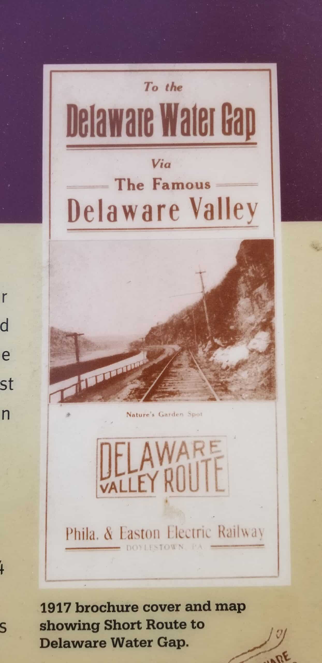
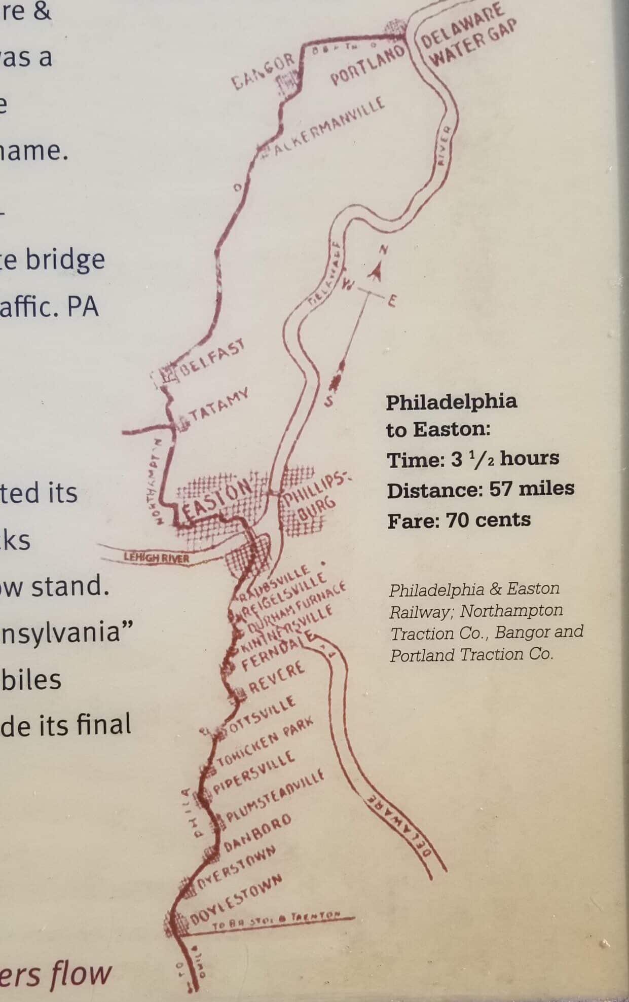
Another bridge that once existed in the same area as the modern bridge and the M. Opp Bridge was built in the early 1900s to carry a trolley line across Fry’s Run. As the sign explains, the 32-mile trolley line connected Doylestown with Easton from 1904 to 1926, when it became obsolete due to the increasing popularity of motor cars.

If you want to visit Fry’s Run Park and the historic M. Opp Bridge, you may want to drive there, but you don’t have to. The popular Delaware & Lehigh (D&L) trail passes by the park on the other side of Rt. 611, between the D&L Canal and the river. Much of that trail consists of a towpath that was used by mules that pulled barges while the canal was in operation nearly 200 years ago.

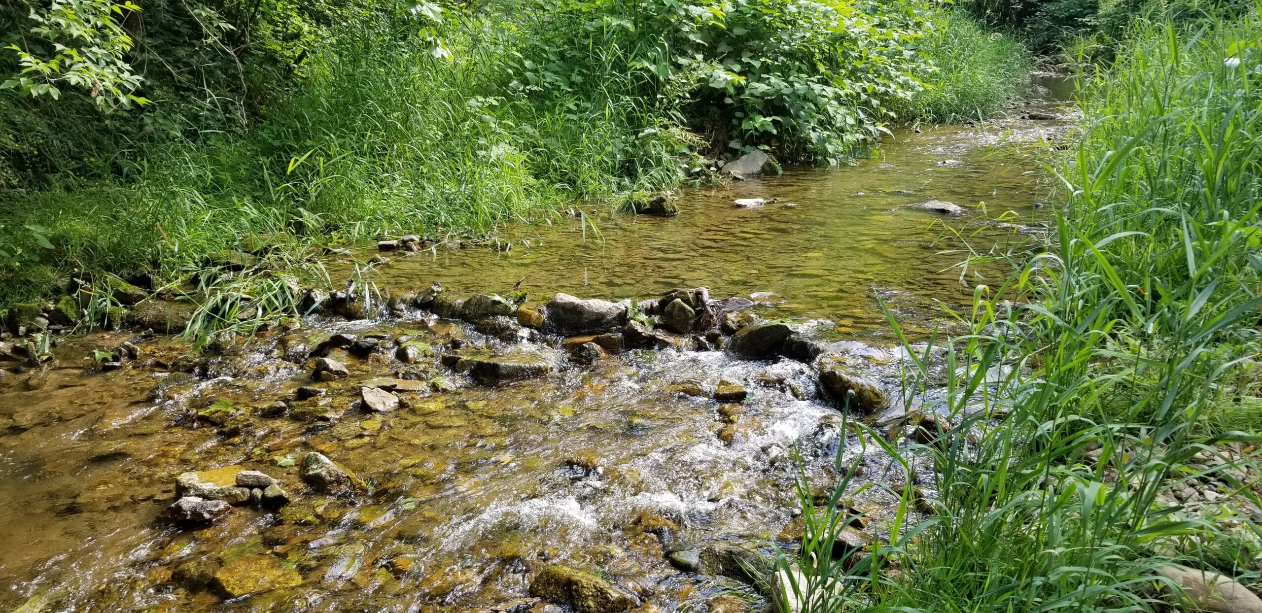
Fry’s Run Park is open daily from sunrise to sunset and features picnic tables, paths and a section of streambank that was restored in the 2010s. There is a small parking area for the park that can accommodate approximately four vehicles on Royal Manor Drive at Rt. 611. For more information about the park, visit the Northampton County website.

The M. Opp Bridge, built in 1824, is the oldest surviving span in Northampton County and one of the oldest bridges in this part of the Delaware River valley. Although the bridge hasn’t been used to get from point A to B for more than a century, it can still be admired in Fry’s Run Park, which surrounds it. The county-owned park is located at Royal Manor Drive and Rt. 611 (River Road) in Williams Township.

In the early 1900s, a trolley line crossed Fry’s Run in the area of the historic bridge. The line, which was in operation from 1904 to 1926, once connected Easton and Doylestown.

An interpretive sign in the park includes a photo of advertising for the former trolley line, which extended north from Easton to Delaware Water Gap.

A map of the former Delaware Valley route is part of the park sign near the historic bridge. The trolleys that traversed the line stopped at many towns and villages in Northampton and Bucks counties.

Fry’s Run is a babbling brook that empties into the Delaware River just east of Rt. 611 and the historic M. Opp Bridge. In addition to its scenic beauty, the waterway is also a prized fishing stream.

Grass now covers what was once the roadbed atop the bridge.

The bridge may be viewed from the observation deck as well as from below, next to Fry’s Run. Beyond it is the modern Rt. 611 bridge across the creek. The current bridge was constructed in 2011.

A sign marks the entrance to Fry’s Run Park on Royal Manor Drive in Williams Township. The 4.8 acre park is owned and maintained by Northampton County.

An interpretive sign on the observation deck that overlooks the M. Opp Bridge details its nearly 200-year history.

The stone that is inscribed with the year of the bridge’s construction–1824–and “M. Opp” has become difficult to read due to the effects of weather and time, however it is still somewhat legible.

A second sign on the observation deck highlights the history of Coffeetown; the village that was once a hub of industrial activity where Fry’s Run enters the Delaware River. Today, it is a collection of houses.


Newsletter

Subscribe to receive our newsletter in your inbox every Monday, Wednesday & Friday.

Please wait...

Thank you for subscribing!

About the author

Josh Popichak

Josh Popichak is the owner, publisher and editor of Saucon Source. A Lehigh Valley native, he's covered local news since 2005 and previously worked for Berks-Mont News and AOL/Patch. Contact him at josh@sauconsource.com.

Leave a Comment