REMINDER: Please like and follow the Saucon Source Facebook page and on Twitter and Instagram for up-to-the-minute updates on the storm and share photos and other information there. Submit breaking news related to the storm to jo**@sa**********.com or via the Facebook page.
A massive late winter coastal storm that’s predicted to strike the Mid-Atlantic and Northeast Tuesday is now forecast by the National Weather Service to bring 18 to 24 inches of snow to the Lehigh Valley area, including Hellertown and Lower Saucon Township, in what could be a historic March weather event.
Ahead of the storm, Hellertown borough has declared a snow emergency that will take effect at 5 p.m. Monday and remain in effect until further notice. A snow emergency means vehicles must be removed from designated snow emergency routes. Public parking lots will be available for use (Water Street Park, Dimmick Park, Tobias Drive lot and Post Office lot). The borough of Fountain Hill has also declared a snow emergency, which will take effect at 9 p.m. Monday.
For information about snow emergency routes in the borough please visit www.hellertownborough.org/snow.
ALERT: Garbage and recycling collection scheduled for Tuesday, March 14 is postponed until Wednesday, March 15.
In the updated winter storm warning NWS issued Monday morning, it said snow will begin “Monday evening from southwest to northeast across the warning area, becoming heavy at times with snowfall rates of one to two inches per hour late Monday night and Tuesday morning. Snow will diminish by Tuesday evening.”
“The heavy snow will make many roads impassable and may produce widespread power outages due to the weight of the snow on tree limbs and power lines,” the warning said.
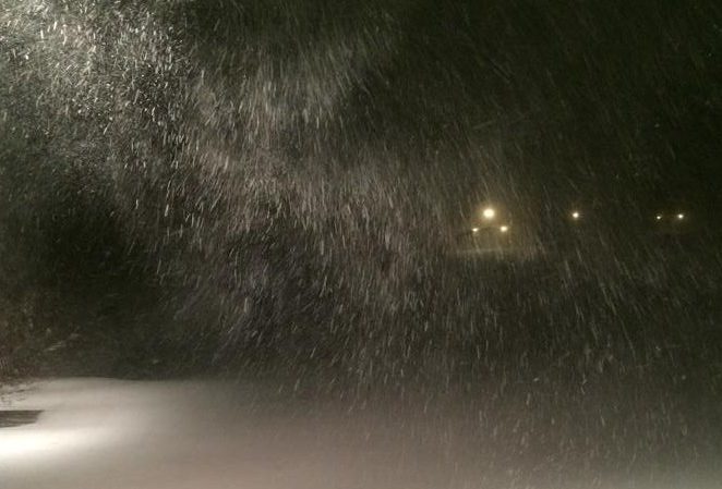
Although the storm may not qualify as a true blizzard, blizzard-like conditions are expected in parts of the area due to strong winds that could create near whiteouts at times.
Area residents are being advised to only travel in an emergency during the storm.
FOR WINTER SAFETY INFORMATION FROM THE NATIONAL WEATHER SERVICE, CLICK HERE.
“If you must travel, keep an extra flashlight, food and water in your vehicle in case of an emergency,” the NWS said.
In their second call forecast for the storm Sunday, Eastern PA Weather Authority predicted 18 to 24+ inches of snow for most of eastern Pennsylvania and also placed the Lehigh Valley in an area on the map where blizzard conditions are possible.
On their Facebook page, EPAWA said a final call will be issued at 5 p.m. Monday, but may be the same call that now stands.
Stay tuned to your local weather forecasts for continued updates on this approaching storm.
Residents who live next to fire hydrants are reminded to make sure they are kept shoveled out. A fire hydrant buried in snow could result in an unnecessary tragedy.
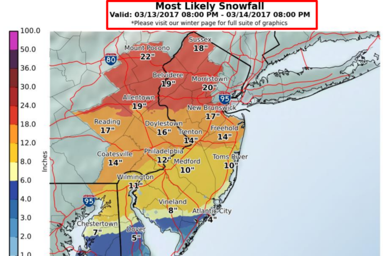
A snowfall prediction map from the National Weather Service office at Mount Holly, N.J., lists the most likely snowfall total for Allentown as 19 inches.


