Winter Storm Watch Issued for Possible ‘Long Duration Winter Storm’
Just when you thought the weather was quieting down, Old Man Winter is preparing to rear his white and wizened head later this weekend, when forecasters say he could wallop our area with snow and ice.
Just when you perhaps thought the weather was quieting down a bit, Old Man Winter is preparing to rear his white and wizened head later this weekend, when forecasters say he could wallop our area with snow and ice as we turn the calendars to December 2019.
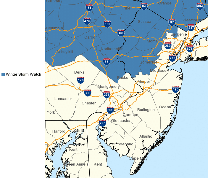
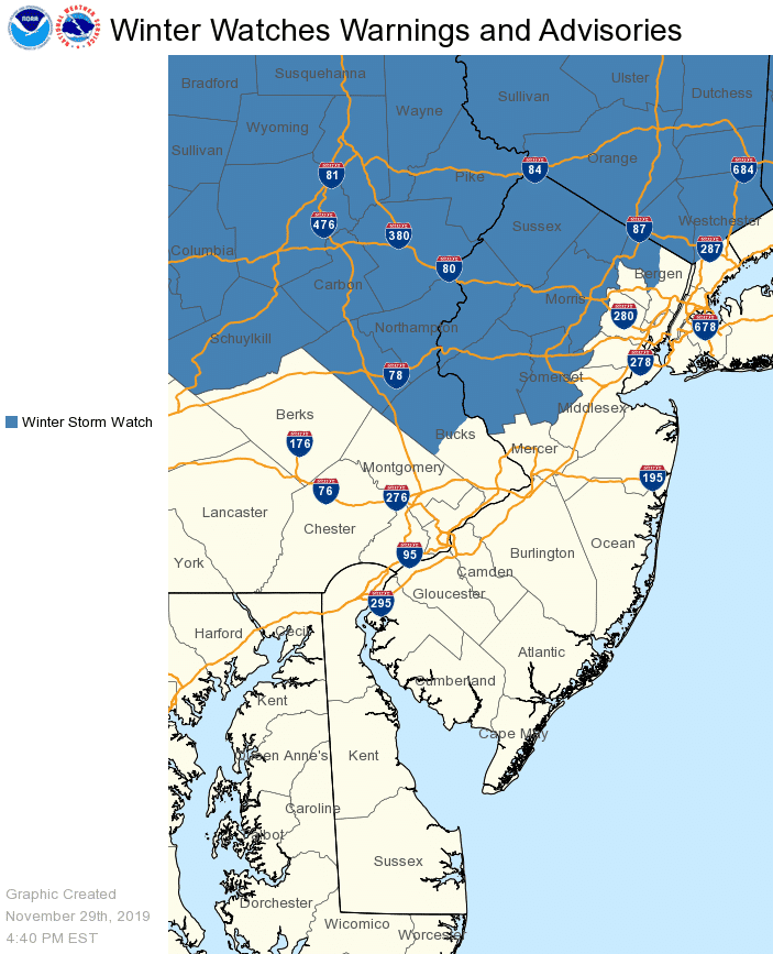
The National Weather Service issued a winter storm watch late Friday afternoon for an area that includes Northampton, Lehigh and Upper Bucks counties.
The watch is in effect from Sunday morning through Monday evening, which is when NWS forecasters say travel conditions will deteriorate, as a mixture of wintry precipitation moves into the area and refuses to move out quickly.
“This will be a long duration storm with two main periods of winter weather,” according to the watch statement. “Conditions on Sunday are expected to consist of a mix of snow, sleet and ice, with snow accumulations under two inches. A lull in precipitation is possible Sunday evening. Most of the snow that is forecast is then expected to occur later Sunday night and Monday.”
“Travel could be very difficult throughout this period,” the NWS warned. “The hazardous conditions could impact holiday return travel on Sunday and the commute periods on Monday.”
Although most businesses and government agencies that were closed Thursday and Friday for the Thanksgiving holiday will reopen for regular hours on Monday, many schools will still be on break, which should reduce the amount of traffic on area roads.
Lehigh Valley Weather Authority also noted the duality of the impending storm scenario in a Facebook post Friday afternoon.
“In addition to the snow/sleet/freezing rain threat for Sunday, I am tracking a potentially major snow storm that would affect the region on Monday,” forecaster Tony Luchini posted. “This appears to be a tricky set-up and nothing is set in stone, but keep it in the back of your mind. Maps and texts alerts will go out Saturday if warranted.”
Author