Ahead of Storm, Hellertown Borough Declares Snow Emergency
The likelihood that a major winter storm will strike eastern Pennsylvania Wednesday prompted borough officials in Hellertown to declare a snow emergency, which will take effect at 7 a.m. Dec. 16 and remain in force until further notice.

The likelihood that a major winter storm will strike eastern Pennsylvania Wednesday prompted borough officials in Hellertown to declare a snow emergency, which will take effect at 7 a.m. Dec. 16 and remain in force until further notice.
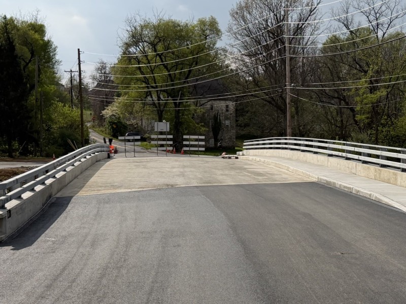
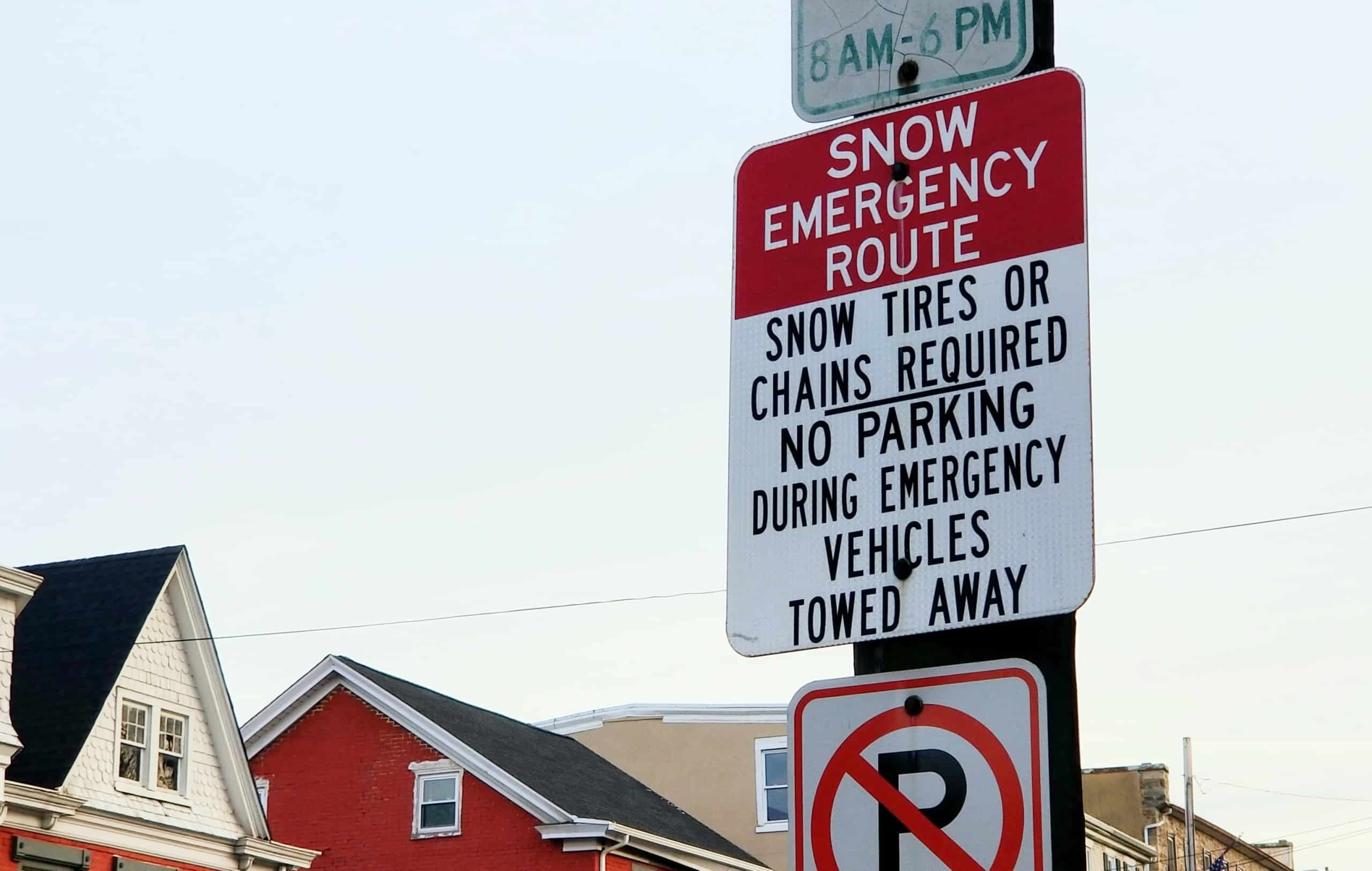
During a snow emergency, vehicles must be removed from designated snow emergency routes in Hellertown borough.
Those routes, which are prominently signed, are as follows:
- Front Street from Sycamore to Walnut
- Main Street from 1-78 to Polk Valley Road
- Easton Road from Cherry Lane to Main Street
- Northampton Street from Easton Road to Walnut Street
- Rentzheimer Drive from New York Avenue to Walnut Street
- Tobias Drive from Durham to Walnut
- Constitution Avenue from Durham to Walnut
- Willow Road from Durham Street to Constitution Avenue
- Cherry Lane from Main Street to Easton Road
- Wagner Avenue from Main Street to Zimpfer Lane
- High Street from the Railroad Bridge to Easton Road
- Linden Avenue from Main Street to the Steel Club entrance
- Sycamore Street from Front to Main
- Depot Street from Front to Main
- Depot Street from Easton Road to Durham Street
- Water Street from the borough line to Rentzheimer Drive
- Penn Street from Main Street to Delaware Avenue
- Durham Street from Delaware Avenue to the borough line
- Magnolia Road from Front Street to Willow Road
- Walnut Street from the borough line to Constitution Avenue
Plowing the snow emergency routes is the responsibility of the borough’s public works department.
In adjacent Lower Saucon Township, a snow emergency–if one is declared–is largely a procedural matter, since few roads have on-street parking. In the case of cul-de-sacs in the township, vehicles must be removed from the street to allow plows to reach the curb.
Local roads in the township are maintained by the Lower Saucon public works department, while major roads such as Rt. 412 (Leithsville Road) and Rt. 378 are plowed and treated by PennDOT road crews.
Citing copious calls township staff typically receive about the condition of state roads, officials published a reminder to residents Wednesday to call PennDOT at 610-250-1840 if they have a concern about one of their roads. A list of state roads in Lower Saucon Township–which collectively total more than 30 miles in length–can be found here.
In Hellertown, residents who must move their cars from snow emergency routes may park them temporarily in one of the borough’s parking lots, which are located at Water Street Park, Dimmick Park, Tobias Drive and the Hellertown Post Office. Residents who utilize these lots during the storm do so at their own risk, the borough said in its update.
The update also included a reminder to residents who live next to fire hydrants to clear snow from them within a three-foot radius, as well as information about sidewalks in the borough, which must be cleared of snow within 24 hours of a winter weather event.
Hellertown residents should be aware that the garbage collection scheduled for Thursday, Dec. 17, has been rescheduled for Friday because of the impending storm. On Friday, a double route will be collected.
The forecast for Wednesday’s storm changed slightly during the day on Tuesday, when possible snowfall totals were downgraded slightly.
Earlier in the day, the National Weather Service warned of the possibility of as much as two feet of snow from the storm. However, by evening the forecast was lowered to 12 to 20 inches, due to the possibility that sleet may mix with the snow.
“Snow will move in from southwest to northeast Wednesday afternoon and early evening,” the NWS noted in a winter warning statement. “The snow could become heavy at times Wednesday evening into Wednesday night, before ending Thursday morning.”
Winds gusting as high as 35 mph combined with the heavy snow could result in power outages throughout the region, the weather service said, and travel is likely to be “very difficult to impossible” for a period of time late Wednesday and early Thursday.
In his “final call” forecast, Pennsylvania Weather Action forecaster Josh Adams lowered his snowfall total predictions for southeastern Pennsylvania, due to the fact that the storm is now expected to track closer to the coast.
Monday’s predicted snow total for Allentown was 17 inches, which was lowered to 11 inches Tuesday. Easton was also forecast to receive 11 inches, with significantly lower amounts shown on Adams’ forecast map south of the Lehigh Valley. In the Poconos and throughout north central Pennsylvania, however, Adams believes the Nor’easter may dump up to two feet of snow.
Also in advance of the winter storm, Pennsylvania Gov. Tom Wolf took action Tuesday by signing a proclamation of disaster emergency.
“Currently, models predict that the first significant winter storm in nearly a year will hit Pennsylvania tomorrow,” Wolf said during a virtual news conference. “The commonwealth’s emergency preparedness teams have spent a great deal of time and energy over the last several months supporting efforts to mitigate the COVID-19 pandemic and help the commonwealth weather this public health emergency and ensure vaccines are delivered as planned. This proclamation makes it easier for all of those involved in vaccine delivery and keeping people safe to do their jobs.”
The latest briefing on the storm from the National Weather Service office at Philadelphia and Mount Holly, N.J., may be found here. In the 6 p.m. Tuesday briefing, the NWS forecasters put the Lehigh Valley in a zone in which 12 to 18 inches of snow are forecast.
From approximately the Bucks County-Northampton County line south to Philadelphia, the map indicated that “mostly snow and sleet” is now expected, with a sharp gradient between types of precipitation across the Wilmington, Del., to Trenton, N.J., corridor.
Author