Storm Dumps Over a Foot of Snow on Parts of Area
The highest amounts reported to the National Weather Service across eastern Pennsylvania were generally in upper Bucks, southern Lehigh and southern Northampton counties, where Hellertown received close to 12 inches of snow.
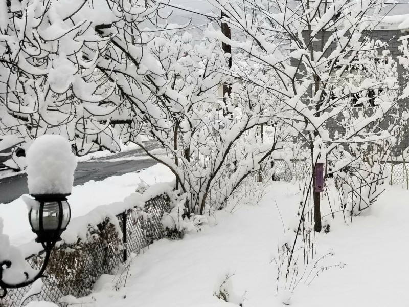
A relatively weak winter storm that was only supposed to deposit a few inches of snow overperformed overnight and dumped more than a foot of powder on parts of the Lehigh Valley.
The highest amounts reported to the National Weather Service across eastern Pennsylvania were generally in upper Bucks, southern Lehigh and southern Northampton counties, where Hellertown received close to 12 inches of snow.
Significant snowfall totals reported in the ‘jackpot zone’ included:
NORTHAMPTON COUNTY
Hellertown: 11.8 inches
Bethlehem: 10.5 inches
LEHIGH COUNTY
Center Valley: 13.8 inches
Emmaus area: 12.8 inches
South Allentown area: 12.1 inches
BUCKS COUNTY
Kintnersville: 13 inches
Passer area (Springfield Township): 13 inches
Springtown area (Springfield Township): 12.2 inches
Quakertown: 8 inches
The precipitation was especially heavy in an area along and south of Interstate 78 because a heavy snow band developed there, which prompted the National Weather Service to upgrade the winter weather advisory it had issued Friday to a winter storm warning at around 1 a.m. Saturday. The Mount Holly office of the NWS also issued a special weather statement early Saturday morning in which it said that snowfall rates of 2 to 4 inches per hour had been reported in the area being affected by the band, with additional snow at rates of up to 3 inches an hour expected.
North and south of the heavy snow band, precipitation totals were much lower. Lehigh Valley International Airport, in Hanover Township, Lehigh County, north of Allentown, received less than six inches of snow and locations in the Poconos generally received four inches or less. Philadelphia also received less than four inches. The heavy snow band extended east into central New Jersey, where it also dumped more than a foot of snow in places like Frenchtown, Hunterdon County, which received 13 inches, and North Brunswick, Middlesex County, which received 11.3 inches.
Unlike the snow that fell in Tuesday’s storm, the snow that fell Saturday was light and powdery, which made the clearing sidewalks and cleaning off cars a bit less onerous.
Some places like the Bethlehem Area Public Library closed Saturday because of the storm, and the City of Bethlehem issued a notice stating that curbside recycling was not completed due to the weather. Residents whose recyclables weren’t picked up were advised to leave them out for pickup on Monday, Feb. 19.
The storm exited the area by late Saturday morning, and the sun emerged, although some snow squalls developed Saturday afternoon as cold air filtered across the region from the northwest.
Saturday night’s low temperature was forecast to be 18 degrees. However a warming trend is predicted after the weekend, with highs in the low to mid 40s expected later in the week.
Author